
Department of
Civil Engineering.
About the Department
The Department of Civil Engineering, established in 2008, has been at the forefront of teaching, research, and consulting across Geotechnical, Structural, Transportation Systems, Hydraulics and Water Resources, and Environmental Engineering. Our alumni have excelled in industries and institutions in India and abroad. The department conducts both fundamental and applied research to develop solutions that advance the future of Civil Engineering. It offers B.Tech, M.Tech, and PhD programs in various specializations, with faculty dedicated to delivering expertise and addressing societal needs through research.
Our Vision
To become a pioneering civil engineering department in the world for teaching, research and consulting in the existing and emerging areas
Our Mission
To prepare the next generation of civil engineers to address a broad spectrum of problems that are central to sustainability and economic growth of the country
Upcoming Events
View All EventsInternational Workshop on Nonlocal Mechanics Approaches for Modelling Localized Deformations (NMAMLD 2026), 14–16 December 2026
The International Workshop on Nonlocal Mechanics Approaches for Modelling Localized Deformations (NMAMLD 2026), scheduled for 14–16 December 2026, focuses on advanced modelling techniques for localized deformation, damage, fatigue, and fracture in engineering materials. Nonlocal mechanics incorporates intrinsic length scales to enable accurate, mesh-independent simulation of strain localization and crack evolution under quasistatic, dynamic, and cyclic loading. The workshop will cover integral, gradient-enhanced, and phase-field approaches applied to metals, concrete, and composites. Building on successful editions in 2020 and 2022, NMAMLD 2026 will bring together global experts to share insights, foster collaboration, and advance research in computational mechanics.
Latest News
View All News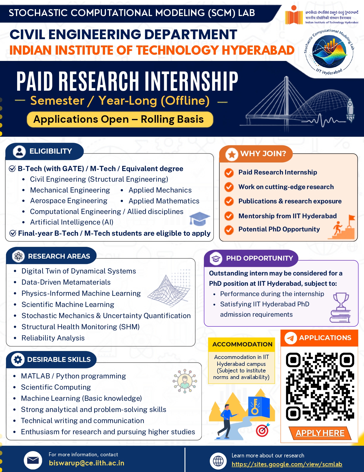
Paid Research Internship at Stochastic Computational Modeling (SCM) Lab, IIT Hyderabad
Gallery
View Full Gallery
Our Achievements
View All Achievements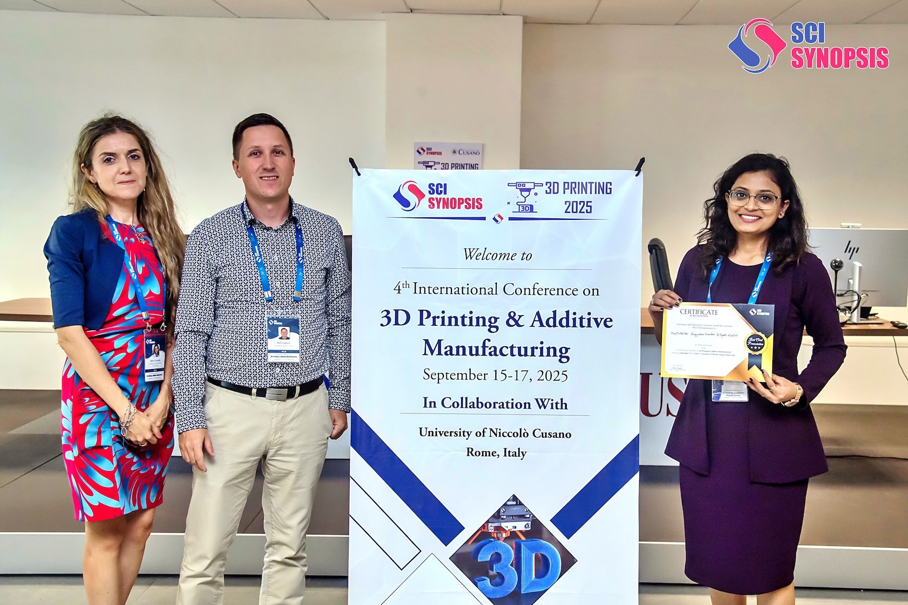
IIT Hyderabad Congratulates Ms. Bhagyshree Khandare on Best Oral Presenter Award at International Conference
Get in Touch
Have questions about our programs, admissions, or placements? We're here to help you every step of the way.
Contact Us
Get in touch with us through any of the following ways.
Address
CE Block, IIT Hyderabad, Kandi,
Sangareddy, Hyderabad,
Telangana, India
Phone
+91 40 23016300Find Us
Located at IIT Hyderabad Campus
Send us a Message
Fill out the form below and we'll get back to you as soon as possible.